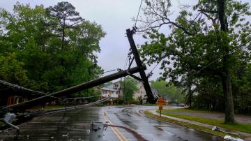
Parts of the South have got more than 10 inches of rain in the past 10 days.
February 17, 2020, 11:53 AM
3 min read
We are watching a storm system move across the country to bring more rain to the already flooded South.
This morning, flood warnings continue for rivers across the South from Texas to the Carolinas with major flooding occurring only in Mississippi on the Perl River and on Big Black River. All the other rivers are not in major flooding as of now.
Over the last week and a half, parts of the South got more than 10 inches of rain pushing many rivers over their banks into flooding.
Over the last week and a half, parts of the South got more than 10 inches of rain pushing many rivers over their banks into flooding.
Over the last week and a half, parts of the South got more than 10 inches of rain pushing many rivers over their banks into flooding.ABC News
The forecast for the Perl River in Jackson, Mississippi, says it is set to crest sometime this afternoon at the third highest crest ever recorded at 37.5 feet. The last time it was this high was in 1983 when it was 39.5 feet.
There is a new storm system moving out of the Rockies tonight that will bring heavy rain to most of the South and most areas will see an additional two to three inches of rain with localized amounts of three to four inches.
There is a new storm system moving out of the Rockies tonight that will bring heavy rain to most of the South and most areas will see an additional two to three inches of rain with localized amounts of three to four inches.
There is a new storm system moving out of the Rockies tonight that will bring heavy rain to most of the South and most areas will see an additional two to three inches of rain with localized amounts of three to four inches.ABC News
To the north and west, this storm system will bring mostly two to six inches of snow with up to a foot possible in the Colorado Rockies.
A Winter Weather Advisory has been issued from Nebraska to northern New York state where some areas could see up to two inches, but as many as seven inches, of snow!
Behind this storm system, there is another shot of colder air moving into the Midwest and the Northeast and, by Wednesday and Thursday, wind chills could be below zero once again for the Upper Midwest and the Great Lakes. This cold blast moves into the Northeast by Thursday into Friday.
There is another shot of colder air moving into the Midwest and the Northeast and, by Wednesday and Thursday, wind chills could be below zero once again for the Upper Midwest and the Great Lakes.
There is another shot of colder air moving into the Midwest and the Northeast and, by Wednesday and Thursday, wind chills could be below zero once again for the Upper Midwest and the Great Lakes.ABC News


